Several weather warnings are in place for Queensland and New South Wales as an East Coast Low builds off the coast, while Victorians continue to shiver through a record-breaking cold snap.
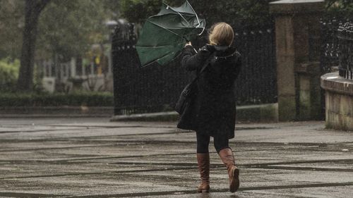
Both Queensland and NSW have been issued with marine wind and hazardous surf warnings, with the low pressure system expected to bring heavy rain to a broad swathe of coastline.
Wind gusts of 65km/h have been recorded at the Gold Coast Seaway this morning, and the weather event could deliver up to 30mm of rain to Brisbane tomorrow and 15mm to Sydney.
Amid the system, Weatherzone has warned there may not be an end in sight to the wet weather.

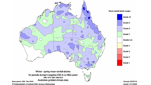
“Four of the seven international climate models surveyed by the BoM predict that La Niña will redevelop by late-spring,” the weather service writes.
“If La Niña does redevelop later this year, most forecast models suggest that it may be short-lived and break down early next year.
“Like the negative IOD, La Niña increase the likelihood of above average rainfall over large areas of Australia. When they both occur at the same time, virtually all of Australia can expect to see more rain than usual.”

Record-breaking cold snap
As Queensland and NSW brace, it’s been revealed Melbourne recorded it’s coldest morning in four years yesterday.
The mercury dipped to a chilly 0.8C in the Victorian capital.

More than half of the state registered temperatures below zero degrees.
The lowest temperature was seen in Mt Hotham, which recorded -7.4C and Coldstream hit -3.8C.
Icy conditions are continuing in Melbourne today, with a low of 1C is forecast.
The cold snap is has been driven by a high pressure system passing over southeastern Australia, following the trails of a cold front.
This has caused a wintry combination of cold air, clear skies and light winds.


التعليقات